The sea level is rising all around the world; that inconvenient truth is part of the fact of climate change. But in California, rising sea level for the most part will not pose novel problems. We’ve had ample experience with the problems under the label of “coastal retreat”: even with a steady sea level, waves and tides will attack the land and beat it back without mercy. A rising sea makes things only a little worse than what we’re used to, or at least what geologists are used to.
Up and down the California coast, the sea has been carving cliffs into the shore and excavating them in the form of sand, which the currents carry from place to place. The main thing that protects the cliffs, moderating the inevitable, is that sand. Today’s balance of beaches and bluffs—rather, the balance that the first European settlers witnessed around 1800—took thousands of years to achieve after the last ice age ended, about 10,000 years ago.
Historically—and geologically—that balance included lots of sand entering the shore zone from rivers. But the addition of 38 million people to California in the last two centuries has led to the damming of nearly every river in the state, and now very little river sand is in the mix. Beaches are smaller now, and the sea level makes a bigger difference these days. Coastal retreat will inexorably step up its pace. During El Niño episodes, our sea level can be be more than a foot higher on top of our king tides and storm surges.
How should we think about this in policy terms? Consider this case, from the long-term aerial surveys collected at californiacoastline.org.
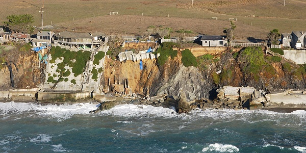
This set of coastside homes along state route 1 north of Bodega Head, put in place some time before 1972, looked like this in 1979.
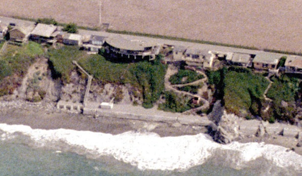
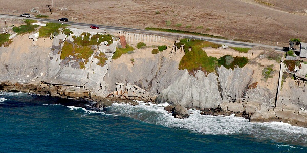
Already, sea walls had been built at the base of the bluff to protect the slope from winter surf. Also note the landslide scars on the left (north) side. In 2002, a generation later, most of these homes were gone or abandoned.